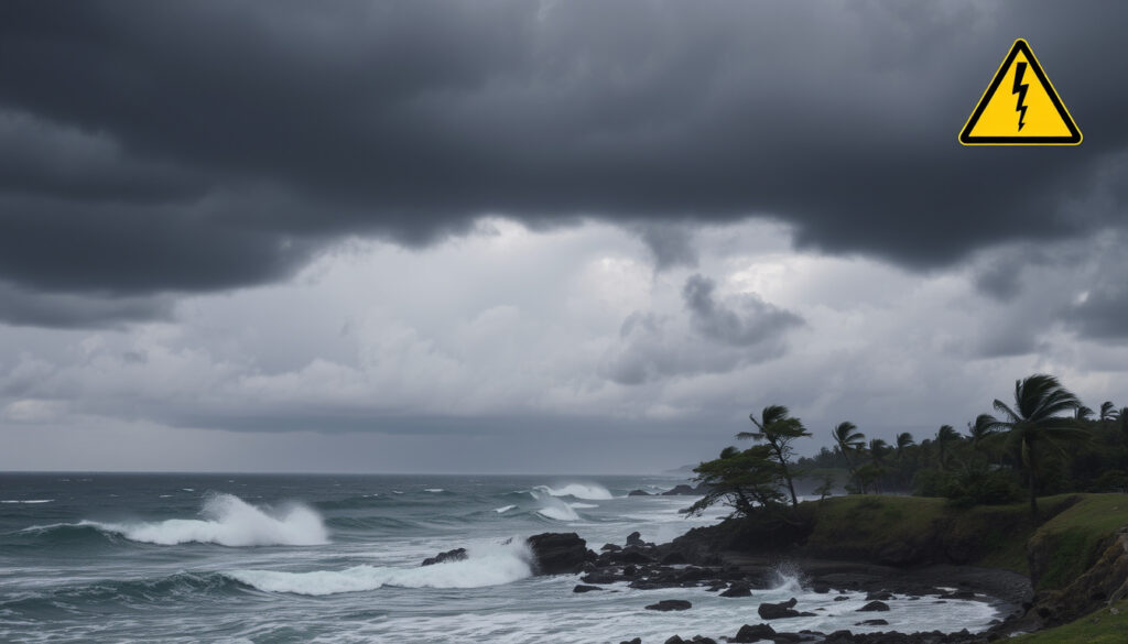
Storm Chandra Weather Warnings: Status Yellow Alerts
Few things focus the mind like a named storm, especially one that arrives when the ground is already saturated. Storm Chandra is putting Ireland’s warning system to the test, with Met Éireann’s Status Yellow alerts for rain and wind covering eastern and southern counties (TheJournal.ie (Irish online news outlet)), raising the question of whether this storm says anything about summer heat and what the warnings actually mean.
Storm Name: Chandra ·
Date of Impact: 26–27 January 2026 (Met Éireann) ·
Warning Status: Status Yellow rain and wind ·
Affected Regions: Eastern and southern Ireland, Northern Ireland ·
Peak Wind Gusts: Coastal gales expected; 60–70 mph possible in eastern NI
Quick snapshot
- A nationwide Status Yellow wind warning is in force for Storm Chandra, with the strongest winds on coasts and exposed areas (The Irish Times (Irish daily newspaper)).
- A Status Yellow rain warning covers southeastern counties, with heavy rain falling on already saturated ground (RTÉ News (national public broadcaster)).
- The entire island remains under a wind alert, ending at 23:00 in the Republic and midnight in Northern Ireland (TheJournal.ie).
- Whether Storm Chandra will break local rainfall records as it moves east.
- The exact track of the storm centre after Tuesday.
- How much of the difference between yellow and amber warnings maps to actual conditions on the ground.
- Storm Chandra was named on 26 January 2026, and an amber wind warning for eastern Northern Ireland includes gusts of 60–70 mph, with 75 mph possible on coasts (Met Office (UK national weather service)).
Ireland’s warning system is colour-coded, and Storm Chandra is producing a yellow alert — not the red that many people search for. The table below tracks the current status, the areas affected, and the official sources behind the warnings.
| Category | Status / Value |
|---|---|
| Storm name | Chandra |
| Named by | UK Met Office, 26 January 2026 (Met Office) |
| Warning type | Status Yellow rain and wind island-wide |
| Rain warning counties | Carlow, Kilkenny, Louth, Waterford, Wexford, Wicklow (Irish Independent (Irish newspaper)) |
| Wind warning counties | Cork, Waterford, Dublin, Louth, Wexford, Wicklow, Carlow, Meath, Kildare, Monaghan, Cavan (Irish Independent) |
| Counties under alerts | 13 on Tuesday 27 January (Irish Independent) |
| National wind warning | Whole country, Status Yellow, from 03:00 to 23:00 Tuesday |
| Northern Ireland | Amber wind warning for eastern areas; gusts of 60–70 mph, 75 mph possible on coasts (Met Office) |
| Flood risk | Heavy rain on saturated ground; rivers near bank-full (Met Éireann) |
| What to watch | Coastal gales and localised flooding |
Those are the official facts. The questions people are actually searching go beyond the 48-hour forecast — and some of them have no answer yet.
Will we get another heatwave this summer?
Every named storm triggers the same seasonal question on Irish social media: does this mean summer will be hot? The short answer is that a winter storm forecast does not reach that far ahead.
Heatwave frequency in Ireland
- Storm Chandra arrived after a wet and unsettled spell that left rivers high — a reminder that Ireland’s baseline weather is variable.
- The rain warning matters because heavy rain is falling on already saturated ground, which turns an ordinary warning into a flood risk.
Long-term climate projections for Ireland point toward more frequent heat extremes in the coming decades, but no national forecaster is issuing a summer 2026 heat alert from this week’s data. The honest answer to the question is: not knowable yet.
Storm Chandra is a winter hazard, not a climate forecast. But the saturated ground it landed on is the kind of visible signal that long-term projections expect to see more of.
Long-range changes in Atlantic weather patterns, not a single storm’s path, will decide whether Irish summers get hotter. The colour today is yellow; the future question is how often the system turns amber or red.
The trade-off: public attention follows a dramatic storm, while the slower work of adapting to heat happens between storms.
Is summer 2026 going to be hot in Ireland?
This question spikes every January, and Storm Chandra has brought it back. The available weather bulletins do not include a summer 2026 forecast.
Long-range weather models for Ireland
- Long-range models gain skill as the season approaches; a January storm offers no reliable signal for July or August.
- Met Éireann’s Storm Chandra commentary is focused on Tuesday’s rain and wind, not on seasonal temperatures.
Searches for “red weather warning Ireland tomorrow” are a separate concern: no red warning is active for this storm. The warning system is colour-coded, and the current level is yellow.
Comparison with 2025 summer temperatures
Summer 2025 data: not covered in reviewed bulletins · Summer 2026 outlook: no published seasonal forecast · Current warning: Status Yellow
The useful comparison is not between one summer and another, but between how the warning system handles winter storms and how it will handle summer heat. Storm Chandra shows the machinery working; a hot summer would use the same channels.
The implication: don’t book summer plans on a January storm. Trust seasonal forecasts when national services publish them, and act on the colour-coded alerts that follow.
Can humans survive 40C?
The question sounds like a climate doomsday search, but it has a concrete physiological answer.
Heat stress thresholds
- Prolonged exposure to 40°C without cooling and hydration can be lethal.
- A wet-bulb temperature around 35°C is the widely cited survivability limit for healthy humans.
- Humidity matters more than the air temperature alone.
40°C is survivable for short periods; the risk builds when nights stay hot and the body cannot cool down. Ireland’s warning colours are designed to give people time before dangerous thresholds arrive.
For Ireland, reaching 40°C would be extraordinary, but heat-health planning is about thresholds, shade, hydration and checking on older neighbours. The same “act before the worst” logic that drives Storm Chandra’s yellow and amber warnings applies when heat alerts go out.
Why this matters: surviving 40°C is not a headline — it is a planning problem for cities, hospitals and households.
Will 2030 be hotter than 2026?
2030 has become shorthand for a climate deadline, and the question mixes long-term projection with year-to-year reality.
Global temperature trends
- The consistent direction of climate models is continued warming over the next decade.
- Greenhouse gas concentrations are the long-term driver; a single winter storm has no measurable effect on that trend.
Regional impacts for Ireland
- A warmer global average raises the odds of more frequent Irish heat extremes, but not every year will be hotter.
- Extreme rainfall events like Storm Chandra are part of the same changing climate picture.
Storm Chandra’s flooding risk is a live example of what happens when heavy rain meets saturated ground. The 2030 question is whether the warning system and flood defences can absorb more of those events, plus heatwaves.
The pattern: each storm is a test run. Every time the system warns early, it builds the habit that will matter in a hotter decade.
Why is 2030 the point of no return?
The idea of a point of no return comes from climate policy, not from storm warnings — but it explains why governments keep citing 2030.
Climate tipping points
- 2030 is frequently cited as a critical year to keep warming near 1.5°C.
- Beyond that threshold, scientists warn of irreversible changes such as ice-sheet collapse and coral-reef loss.
Emission reduction deadlines
- Emissions are cumulative; what is released in the next five years locks in warming for decades.
- For Ireland, the practical question is whether adaptation keeps pace with warnings.
Storm Chandra’s yellow alerts are not climate policy, but they are a reminder of why adaptation spending is not abstract: it shows up as working sensors, flood plans and clear warnings.
The catch: 2030 is a marker, not a switch. The risk curves are already in motion; the warning colours just tell us where we are on them.
Timeline signal
The sequence of warnings shows how a named storm gains official status and then moves through warning tiers.
- 27 January, 03:00 — A Status Yellow wind warning covering the whole country comes into effect (The Irish Times).
- 27 January — Heavy rain warnings are live for southeastern counties, with flooding feared on saturated ground (RTÉ News).
- 27 January, 23:00 — The wind alert ends in the Republic; Northern Ireland follows at midnight (TheJournal.ie).
- From 28 January — The storm weakens; residual flooding remains possible in saturated catchments.
A yellow wind warning is the middle tier, not a red emergency — but with rivers already high, the rain part of this storm deserves as much attention as the wind.
The implication: warnings are issued in sequence, and the public’s job is to act between the first alert and the worst conditions.
What’s confirmed, what’s unclear
Separating established facts from open questions keeps the warning picture honest.
Confirmed facts
- A nationwide Status Yellow wind warning is in force for Storm Chandra, with the strongest winds on coasts and exposed areas (The Irish Times).
- A Status Yellow rain warning covers Carlow, Kilkenny, Louth, Waterford, Wexford and Wicklow (RTÉ News).
- The whole island is under a wind alert until 23:00 Tuesday (midnight in Northern Ireland) (TheJournal.ie).
- An amber wind warning is active for eastern Northern Ireland (Met Office).
- Heavy rain is falling on saturated ground, keeping flood risk elevated (RTÉ News).
What’s unclear
- Whether Storm Chandra will break local rainfall records.
- The exact track of the storm as it exits Ireland.
- Which towns could see significant localised flooding.
- Whether the storm signals anything about summer 2026 temperatures.
- Long-term heatwave frequency remains a model projection, not a forecastable outcome from winter weather.
The pattern: confirmed warnings are about weather; the unclear items are mostly about prediction — and the gap between them is why live updates matter.
What officials said
The official language is careful, precise, and genuinely useful during a storm.
A Status Yellow rain warning across southeastern counties, with heavy and persistent rain expected on already saturated ground.
Met Éireann (national weather service commentary, 27 January 2026)
The warning is in place for eastern parts of Northern Ireland, from 05:00 on Tuesday until 21:00. Winds will escalate with coastal gales.
BBC Weather (forecast service of the BBC)
The winds will be very strong and gusty, particularly on coasts and in exposed areas.
Met Éireann via The Irish Times (The Irish Times live updates)
Why this matters: official warnings share two things — a clear worst-case and a clear time window. Both are present for Storm Chandra.
The takeaway
Storm Chandra is a yellow-warning event that deserves attention because of what it landed on: wet ground, high rivers and coastal communities already on alert. It is not a red-alert storm, and it is not a forecast for summer. What it offers is a live view of how Ireland’s warning system works — and a reminder that the same system will be tested again, in winter floods and summer heat. For commuters and households in the warning counties, the decision is clear: delay non-essential travel until the gales ease, or prepare for the kind of disruption that saturated ground reliably brings.
met.ie, independent.ie, transportforireland.ie, met.ie, metoffice.gov.uk, visahq.com
Frequently asked questions
Short answers to the questions people are searching while Storm Chandra passes.
What is a Status Yellow weather warning?
It’s the middle tier of Met Éireann’s colour-coded system. Yellow means conditions could affect people in the warning area, so it’s time to be alert rather than alarmed. Red is reserved for the most dangerous conditions.
How long will Storm Chandra last?
The main impacts run from Tuesday morning through Tuesday night. The nationwide wind warning expires at 23:00, and Northern Ireland’s amber warning for eastern areas ends at 21:00.
Is Storm Chandra dangerous?
It’s not a red-warning event, but heavy rain on saturated ground and coastal gales create real risks: localised flooding, fallen branches and difficult driving conditions in exposed areas.
Which areas are most affected by Storm Chandra?
Eastern and southern Ireland, including Dublin, Cork, Waterford, Wexford, Wicklow, Carlow, Kilkenny, Louth, Meath, Kildare, Monaghan and Cavan, plus eastern Northern Ireland under the amber wind warning.
Should I travel during the warning period?
If you can delay non-essential travel, do. Pay attention to local conditions in coastal areas, and check Met Éireann or BBC Weather before you set out.
Where can I get live Storm Chandra updates?
Met Éireann is the authoritative source for the Republic; the Met Office covers Northern Ireland. RTÉ News, The Irish Times and TheJournal.ie are carrying live updates.
What is the difference between a yellow and red weather warning?
Yellow means be alert; amber means be prepared; red means take action to protect life and property. Red warnings are rare and reserved for extreme conditions.
Will Storm Chandra cause flooding?
Localised flooding is possible, mainly because heavy rain is falling on already saturated ground with rivers near bank-full. Some catchments may stay waterlogged after the storm passes.
The key is to stay informed through official sources and act on the colour-coded alerts.
More related posts
 Used Electric Cars Ireland: Best Buys & Battery Tips
 Man City vs Plymouth Argyle 3-1: FA Cup highlights and stats
 Real Madrid vs Al Hilal 2025: Match Report, Score & Highlights
 Grand Central Station Belfast: Location, Access, Facilities
 Best Baby Strollers 2025: Expert Picks & Reviews
 Minimum Wage Ireland 2025: Rates, Age Bands & 2026 Increase
 The Living Room Dublin Closure: Why the Sports Bar Closed
 Leaving Cert 2024 Timetable: Official SEC Dates