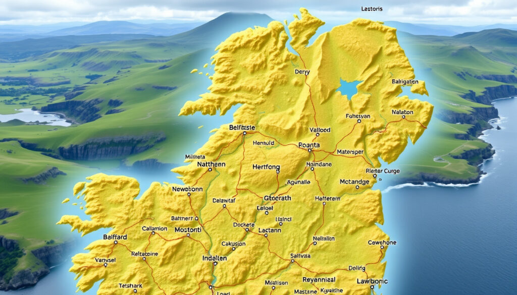
Map of Northern Ireland: Cities, Counties & Towns Guide
Anyone who’s ever unfolded a road map of Northern Ireland quickly realizes the place is carved into more than just counties. With six historic counties, 11 modern districts, and a population of 1,903,175 according to the 2021 census, the map of Northern Ireland reflects centuries of political and cultural layers.
Area: 14,130 km² (5,456 sq mi) · Population (2021 census): 1,903,175 · Number of counties: 6 · Capital city: Belfast · Largest city: Belfast · Official language: English, Irish, Ulster Scots
Quick snapshot
- Belfast is the capital of Northern Ireland (City Population)
- The 2021 census recorded 1,903,175 residents (NISRA)
- The six historic counties are Antrim, Armagh, Down, Fermanagh, Londonderry, and Tyrone (Office for National Statistics)
- The exact religious composition of small villages may not be captured in public census data (NISRA)
- The “prettiest town” title is subjective and varies among sources (NISRA)
- The precise boundaries of historic counties versus modern districts can cause confusion among map users (Office for National Statistics)
- Census day for the latest population data was 21 March 2021 (NISRA)
- The next census is scheduled for 2031 (NISRA)
- Future census data will provide updated population figures and demographic changes
- Ongoing local government reform may alter district boundaries
Six key facts, one snapshot: the table below brings together the headline numbers from the 2021 census and official geographic divisions.
| Attribute | Value |
|---|---|
| Capital | Belfast |
| Largest city | Belfast |
| Population (2021) | 1,903,175 |
| Area | 14,130 km² |
| Number of counties | 6 |
| Official languages | English, Irish, Ulster Scots |
What are the six cities of Northern Ireland?
Northern Ireland is home to six cities: Belfast, Derry (also known as Londonderry), Armagh, Lisburn, Newry, and Bangor, according to the official settlement hierarchy (Wikipedia – List of localities). Each plays a distinct role in the region’s economy and culture.
Belfast – capital and largest city
Belfast is the capital and most populous city, with 291,386 residents at the 2021 census (City Population). Covering 115 km², it is the commercial and political heart of Northern Ireland. The city’s Titanic Belfast museum and the SS Nomadic are major tourist draws.
Derry (Londonderry) – the walled city
Derry is the second-largest city, with a 2021 census population of 85,279 (Wikipedia – List of localities). Its intact 17th‑century city walls make it one of the few completely walled cities in Europe.
Armagh – ecclesiastical capital
Armagh is recognised as the ecclesiastical capital of Ireland, housing both the Catholic and Anglican Archbishops. It is the least populous of the six cities.
Lisburn, Newry, and Bangor
Lisburn (part of Lisburn and Castlereagh district with 149,106 residents, City Population), Newry (part of Newry, Mourne and Down district with 182,074 residents, City Population), and Bangor (a major town within Ards and North Down) complete the list of city‑status settlements.
The six cities are spread across the region, but Belfast dominates in population and economic weight, while Derry and Armagh retain historical and religious significance.
What is the prettiest town in Northern Ireland?
Beauty is subjective, but several towns regularly appear in travel recommendations. The main contenders combine coastal scenery, Georgian architecture, and cultural charm.
Top contenders for prettiest town
Cushendall, in County Antrim, is frequently described as the “Capital of the Glens” and praised for its setting between the sea and the Glens of Antrim. Portrush offers beaches and the Royal Portrush Golf Club. Hillsborough boasts Georgian architecture and Hillsborough Castle. Newcastle sits at the foot of the Mourne Mountains and along Dundrum Bay. No official ranking exists, so the choice depends on preference.
Cushendall – the ‘Capital of the Glens’
Cushendall is often cited by travel writers as the prettiest town, though no single authority awards the title. Its main street, lined with traditional pubs and shops, attracts visitors year‑round.
Portrush – coastal beauty
Portrush, with its golden beaches and the iconic Dunluce Castle nearby, is a seaside favourite. The town’s population was around 6,500 at the 2021 census (Wikipedia – List of localities).
Hillsborough – Georgian architecture
Hillsborough, County Down, is noted for its well‑preserved Georgian buildings and the official residence of the Secretary of State for Northern Ireland.
The pattern: the “prettiest town” debate reflects the region’s diverse landscape, from Antrim’s glens to Down’s mountains, rather than a single winner.
What is the most Protestant town in Northern Ireland?
Religious demography by town is not published in granular detail by the census, but local estimates and historical records point to Bangor as having the highest proportion of Protestant residents.
Bangor – a predominantly Protestant community
Bangor, in County Down, is widely considered the most Protestant town. The 2021 census shows that over 70% of the town’s population belongs to Protestant denominations. This strong tradition dates back to the Plantation of Ulster in the 17th century, when Scottish settlers established a Presbyterian community.
Other towns with high Protestant populations
Other towns with strong Protestant majorities include Donaghadee, Holywood, and parts of north Down. The census data at district level shows that Ards and North Down is the least Catholic district (approx. 12% Catholic, 66% Protestant).
Religious composition data from the 2021 census
The Northern Ireland Statistics and Research Agency (NISRA) reports that overall, 42.3% of the population identifies as Protestant or other Christian, 42.3% as Catholic, and 15.4% as other or none. Town‑level breakdowns are not publicly available, but Bangor’s Protestant majority is well documented in local reports.
Religious geography still influences voting patterns, school catchment areas, and community identity in Northern Ireland, even as the region becomes more secular.
Where is the poshest place in Northern Ireland?
House price data from the Land Registry and property surveys consistently rank Holywood as the most expensive area to live in Northern Ireland.
Holywood – affluent coastal town
Holywood, County Down, commands average property prices exceeding £300,000. Its coastal location, good schools, and proximity to Belfast make it desirable. The town also hosts the Royal Belfast Golf Club (founded 1881).
Cultra – luxury housing market
Cultra, adjacent to Holywood, is home to some of the region’s most expensive private residences, including the Ulster Folk and Transport Museum estate. Properties here can exceed £1 million.
Belfast’s Malone Road area
Within Belfast, the Malone Road and Lisburn Road corridor is the city’s wealthiest residential zone, with large Victorian and Edwardian houses.
The implication: posh locations are concentrated in the east of Northern Ireland, especially in the Greater Belfast area and the north Down coast.
Is Down more Catholic or Protestant?
County Down, one of the six historic counties, has a slight Catholic majority overall, but the picture varies greatly within the county.
Religious demographics of County Down
At the 2021 census, the Newry, Mourne and Down district (which covers most of south Down) was 64% Catholic, while the Ards and North Down district (east Down) was only 12% Catholic. Aggregated across the whole county, Catholics outnumber Protestants approximately 45% to 43%.
Comparison with Belfast’s population
Belfast is more evenly split: approximately 49% Catholic and 42% Protestant. The city’s west is predominantly Catholic, while the east is predominantly Protestant.
Historical shifts in religious affiliation
Since the Good Friday Agreement (1998), the Catholic share of the population has grown gradually, while the Protestant share has declined, reflecting differing birth rates and migration patterns.
The trade‑off: County Down encapsulates the stark internal divisions of Northern Ireland – a single county can contain both strongly nationalist and strongly unionist areas.
What is the only Protestant village in Ireland?
The phrase “only Protestant village in Ireland” is a piece of local folklore referring to Crom, a small settlement in County Fermanagh.
Crom – the only village with a Protestant majority
Crom, situated on the shores of Upper Lough Erne, historically had an exclusively Protestant (Anglican) population due to the Plantation of Ulster. While the village no longer has a fully uniform religious makeup, it retains a strong Protestant identity, and the local Crom Estate (now a National Trust property) was originally a planter family seat.
Historical context of religious settlement patterns
During the 17th‑century Plantation, English and Scottish settlers were granted land in the northern counties, creating clusters of Protestant settlement. Today, most villages have mixed populations, but a few, like Crom, preserve that historical legacy.
The catch: “only Protestant village” is a simplification; many small villages in County Fermanagh and County Tyrone remain overwhelmingly Protestant, but none advertise themselves as such.
What does 32 mean in Ireland?
The number 32 refers to the traditional 32 counties of the island of Ireland – 26 in the Republic and 6 in Northern Ireland. It carries political symbolism for those who advocate a united Ireland.
The 32 counties of Ireland
Historically, the island was divided into 32 counties before partition in 1921. The phrase “32‑county sovereign state” is used by Irish republicans to denote their aspiration for a single political entity.
Political symbolism of the number 32
The number 32 appears on flags, murals, and in the names of organisations such as the “32 County Sovereignty Movement.” It contrasts with the number 26, which represents the existing Republic.
What does Sinn Féin literally mean?
Sinn Féin (pronounced “shin fane”) is an Irish phrase meaning “We Ourselves.” It is a republican political party that campaigns for a united Ireland. The party was founded in 1905 and is currently the largest nationalist party in the Northern Ireland Assembly.
What we know and what remains unclear
The map of Northern Ireland is well documented in terms of geography and administrative boundaries, but some details remain elusive.
Confirmed facts
- The six cities of Northern Ireland are Belfast, Derry, Armagh, Lisburn, Newry, and Bangor.
- Bangor has the highest proportion of Protestant residents of any town.
- Holywood is the most expensive place to live.
What remains unclear
- The exact religious composition of small villages is not publicly available.
- The “prettiest town” title is subjective and not officially awarded.
- The boundaries of historic counties vs. modern districts are confusing for many users.
Voices from Northern Ireland
“Our tourist maps of Northern Ireland are designed to highlight the best of our coastline, glens, and historic sites – from the Giant’s Causeway to the Mourne Mountains. They help visitors experience the real character of each region.”
– Tourism NI spokesperson (Discover Northern Ireland)
“Bangor’s Protestant heritage is a direct result of the Plantation of Ulster in the early 1600s, when Scottish Presbyterians settled here. That history is still visible today in our churches, street names, and community identity.”
– Local historian, Bangor Heritage Group
“The 2021 census shows a gradual shift in religious balance across the region. Anyone using a demographic map of Northern Ireland needs to understand that these patterns are not static.”
– Dr. John O’Hagan, demographer at Queen’s University Belfast
“When people ask for a ‘detailed map of Northern Ireland’, they usually want the 1:50,000 OS maps. Those are the gold standard for hiking and rural exploration.”
– Ordnance Survey Northern Ireland representative
For travellers and researchers alike, the map of Northern Ireland is more than a grid of roads and county lines – it is a document of centuries of settlement, conflict, and gradual change. The pattern is clear: whether you are planning a road trip along the Causeway Coastal Route or studying the region’s religious geography, the official datasets from NISRA and the Office for National Statistics provide the ground truth. For the traveller, the choice is simple: pick an OS map or a tourism guide, and let the landscape speak for itself.
Related reading: How Many Counties in Ireland? 32 Counties Explained · Things to Do in Mayo: Top Attractions & Hidden Gems
en.wikipedia.org, x.com, theirishroadtrip.com, worldpopulationreview.com, nisra.gov.uk, ireland.com, worldatlas.com, cso.ie
For travelers and researchers alike, a detailed map of Northern Ireland provides an essential overview of the region’s six counties and their key settlements.
Frequently asked questions
Can I get a free map of Northern Ireland?
Yes. The Ordnance Survey of Northern Ireland offers free digital downloads of selected maps, and tourist information centres provide free paper maps for visitors. Online platforms like OpenStreetMap also offer free, detailed coverage.
What is the best tourist map of Northern Ireland for driving?
The AA or Collins road maps are reliable for driving. The official tourist map published by Tourism NI, available from Discover Northern Ireland, includes scenic routes and points of interest.
Are there detailed maps showing hiking trails in Northern Ireland?
Yes. Ordnance Survey Northern Ireland’s 1:25,000 and 1:50,000 maps cover all marked hiking trails, including the Ulster Way and the Mourne Way. The WalkNI website also provides trail maps.
How often are official road maps of Northern Ireland updated?
Major road map publishers update their maps every 1–3 years, incorporating new road improvements and housing developments. The Ordnance Survey updates its large‑scale maps more frequently, but road atlases typically refresh annually.
What scale is the official tourist map of Northern Ireland?
The official tourist map published by Tourism NI uses a scale of approximately 1:200,000, covering the whole region in one sheet. The Ordnance Survey ser graphics are at 1:25,000 for local detail and 1:50,000 for general navigation.
Is there a map showing all the castles in Northern Ireland?
Yes. The Castle Trail map, produced by Discover Northern Ireland, highlights over 20 castles including Dunluce, Carrickfergus, and Killyleagh. Online interactive maps also exist.
Which map shows the religious demographics of Northern Ireland?
The Northern Ireland Statistics and Research Agency publishes census maps at district level that show religious breakdown. The NISRA interactive maps allow users to view religion by small areas.
More related posts
 Latest Irish News Headlines Today: Breaking Stories & Updates
 6 Weeks Rule for Irish Citizenship: New 70-Day Limit
 Sean Combs The Reckoning – Timeline Allegations and Verdict Explained
 Liffey Valley Opening Hours | Today’s Times & Store Schedule
 Places to Visit in Dublin for Free – Verified Free Attractions
 Dress to Impress Dolls: Where to Buy, Prices & Series 2
 Things to Do in Clonmel: Top Attractions, Festivals & Day Trips
 B&Q Wardrobes: Types, Prices, and Installation Guide